Products
UVS Vision
Onboard computer vision for UAVs — GPS-denied navigation and automatic target detection
A standalone onboard module: all inference runs on the aircraft, on an embedded AI accelerator, with no link to the ground. Two operating modes: GPS-denied visual navigation (map matching → drone position) and automatic detection of military hardware in aerial imagery.
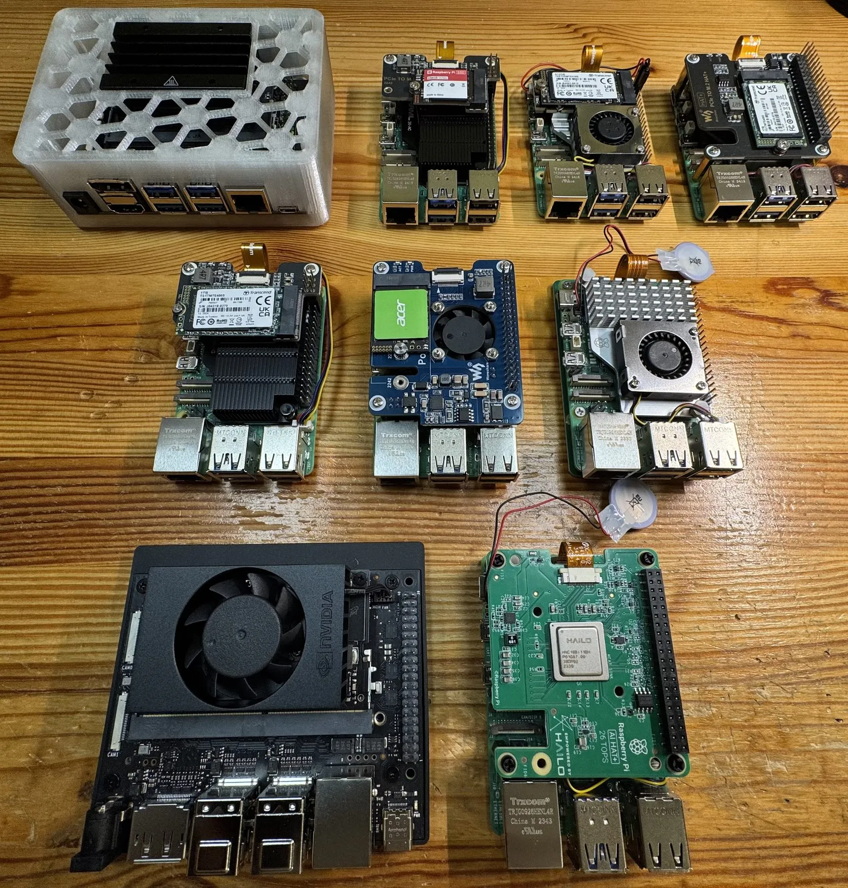
UVS Vision is a separate product line from UVS Dynamics, built around onboard computer vision for UAVs. Unlike our radio links, this module doesn’t depend on a comms channel: all inference runs locally, on an embedded AI accelerator carried by the aircraft. We do not publish the production compute module; the boards on our evaluation bench are shown below.
GPS-denied navigation
The drone matches its live camera feed against a pre-loaded satellite map of the area. The system determines the current position by identifying which map tile the camera is looking at — with no external signal at all. A solution for areas where GPS is jammed by EW or spoofed.
How it behaves across terrain types
Three examples from different flights below. The bigger the contrast between terrain types, the more interesting it gets — the algorithm has to handle both feature-rich scenes and near-uniform fields.
Populated terrain
Buildings, roads and field boundaries provide plenty of unique features. The easiest scenario — the position estimate locks on and stays stable even under fast movement.
Forested terrain
Uniform texture, few obvious landmarks. The model finds unique fragments of pattern and geometry — paths, clearing edges, forest-water boundaries — and holds position where a GPS system would have to fall back to dead reckoning.
Open fields and low-feature terrain
The hardest case — large featureless areas: open fields, snow, steppe. Inter-frame integration and a wider search window do the work here: the algorithm refines its position hypothesis the moment a single characteristic object enters the frame.
These three clips are deliberately the easier case. They were flown for this purpose over open country abroad, under permit — survey footage, not operational footage, and not the hardest conditions the matcher works in. What we publish and what we hold back is set out at the end of this page.
Automatic target detection
The second mode is searching for and classifying military hardware in aerial imagery. The system runs in two operating modes:
- Sector scan. The drone takes wide-area shots from altitude. Each frame is sliced into tiles no larger than 100 × 100 m. A fast single-stage detector runs the first-pass search; the camera then automatically re-focuses and takes a detail shot; a two-stage verifier confirms the class with high precision.
- Real-time tracking. Targets found by the sector scan are then tracked in the live stream. Continuous analysis of the video feed: the camera automatically pans and adjusts focus to keep the target in frame.
Why a separate product
UVS Vision is built on a different set of competencies than the radio links — computer vision, deep-learning models, aerial-imagery processing. The ML work is led by our AI lead, with an in-house pipeline: dataset assembly from open sources, in-house annotation tooling that runs fully offline, training and verification of models. The dataset is 3,782 annotated open-source images (3,026 for training / 756 for validation) across the two classes.
This line evolves in parallel with the radio products: separate go-to-market, separate roadmap. As a module, UVS Vision can be installed on a UAV platform that is already running UVS Link or UVS Link Pro, or on its own as an independent payload.
What is shown here, and what is not
The three clips above are the easy case, and they are the easy case on purpose. Survey footage, flown abroad under permit, a camera locked to nadir with the airframe and the mount both stabilised. That is the friendliest input the matcher will ever get.
The conditions it is actually built for are harder, and we can describe them even where we will not publish them:
- The camera is not where the map expects it. An operator moves the gimbal, so the view is oblique and changing rather than straight down. The geometry the reference tile was captured in no longer holds.
- The ground no longer matches the map. Buildings that stood when the satellite imagery was taken are damaged or gone; the outlines the map records are not the outlines the camera sees.
- The season is wrong. Different vegetation, different field colour, different sun angle and shadow direction from the day the reference was captured.
The matcher holds position through all three at once. It does that because it locks onto the structure that survives — road geometry, field and treeline boundaries, the relative arrangement of what is still standing — rather than onto how the scene looks.
We do not publish that material. Showing it would say more about where and how the system has been used than belongs on a website, and it is worth more to a customer than to anyone else.
So: what is published here is enough to judge the principle. It is not the measure of the system. Fuller demonstration, current performance and technical documentation come by separate agreement — write to us through the contact form with a short brief on the use case, and we will verify the counterparty and agree NDA terms.
Features
- GPS-denied navigation — positioning by matching the live drone view against pre-loaded satellite tiles
- Automatic target detection (aircraft, armoured vehicles) in two modes: wide-area sector scan + real-time tracking
- Two-stage detection — a fast single-stage detector for first-pass search, a two-stage verifier for high-confidence classification
- High-resolution CSI camera with an 8–50 mm varifocal lens — one sensor covers both the wide-area survey pass and the automatic re-focus onto a detected object
- Fully onboard, no link to the ground required — useful in EW-saturated environments
- Standalone module — designed to run as an independent onboard payload